A 950-Foot-Deep Former Coal Mine in Spain Is Now a Lake People Swim In
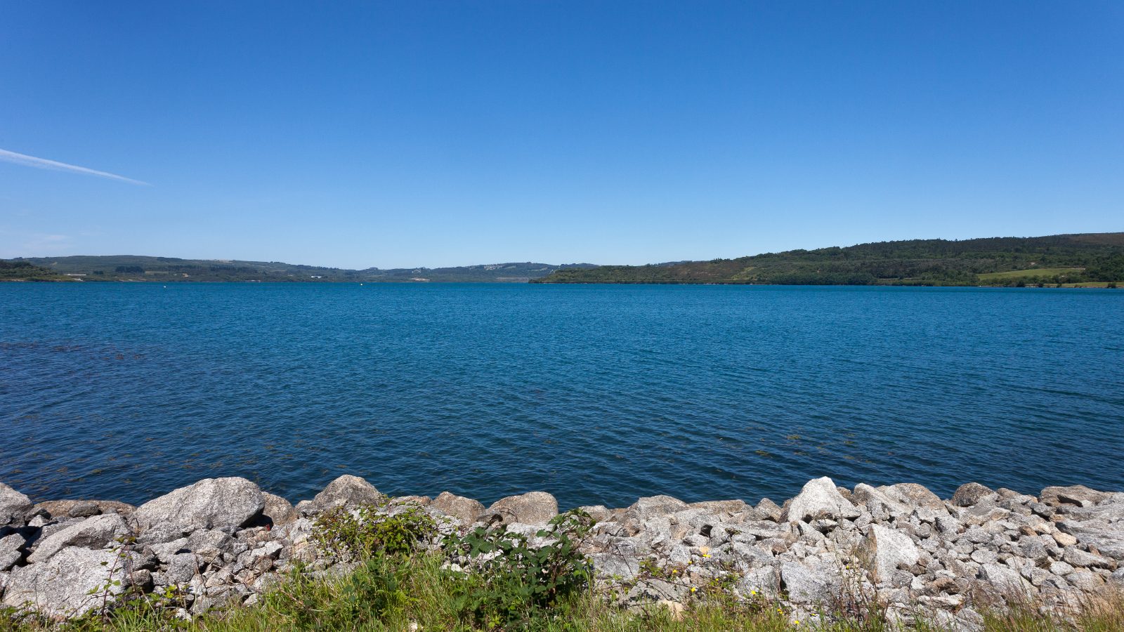
Swimmers at As Pontes de García Rodríguez, in Galicia, get into the water at a sandy beach on a lake that holds a Blue Flag. The certification weighs three things: how clean the water is, whether people with limited mobility can reach it, and whether there is safety cover on hand.
Underneath them is a hole that took more than 30 years of mining to dig.
The hole
When lignite extraction stopped at As Pontes, the pit covered about 3,000 acres. It ran 3.7 miles long, 1.7 miles wide, and 950 feet down at its deepest point. Getting it that big had taken 263 million tonnes of lignite out of the ground, along with 697 million cubic metres of rock and soil that was not lignite and had to go somewhere.
The coal fed a power station of four units and 1,400 megawatts next door. European emissions rules that took effect in 1993 put the plant onto a half-and-half diet of local lignite and imported low-sulphur coal, and annual output dropped from 10 to 12 million tonnes to about 6 million. The mine closed for good on 28 December 2007.
The acid problem
Turning an exhausted open pit into a lake is a standard move, and has been for more than 50 years. The difficulty is not getting hold of the water. It is what the water turns into once it is in there.
Rock that sat undisturbed underground does not stay inert once it has been broken up and left open to air and rain. Sulphides oxidise, acid forms, metals dissolve, and the new lake can end up a large permanent bowl of acid drainage that seeps into everything around it. At As Pontes the question was what the water would look like on the day it started spilling out the far end, into the Eume river.
The chemistry was modelled twice before anything was committed. Vattenfall built one model that treated the lake as a single, perfectly mixed body of water. The AQUATERRA group at the Universidade da Coruña built another that treated it as a stratified column with its own temperature and chemistry at every depth. The stratified version turned out to describe the real lake better. Alongside the chemistry, engineers studied the wave action that would work on the new shorelines and the stability of the mine’s slopes with water pressing against them, rebuilt the watercourses that mining had diverted decades earlier, and installed two seismographs in case the weight of that much new water set anything moving.
Fifty months of water
Filling began in late January 2008. The Eume supplied most of it, topped up by runoff off the restored spoil heaps, groundwater from the mine itself, and rain. It took 548 million cubic metres, and the lake first spilled over in April 2012.
That came to 50 months against a plan of 40, and the reason was the start date. The project had assumed filling would begin in October, with the hydrological year, drawing on every contributing basin from the first day. It began in January instead, and the Eume, the largest single source, was not connected until October 2008.
What is there now
The lake covers about 2,000 acres and holds around 540 million cubic metres at the height where it discharges. Endesa describes it as the largest artificial lake in Spain. Another 1,000 acres between the waterline and the edge of the old workings were replanted for other uses. Restoration on the site had started long before the mine shut: the external spoil heaps, which took about 85 percent of all that waste rock, were being rehabilitated from 1984 onwards, while lignite was still coming out.
Endesa’s published telling of the restoration counts four habitats that came out of the work. “Many years of restoration have finally obtained four different habitats, meadow, scrub, woodland and wetlands, which have evolved naturally along with the local fauna,” said Belén Soto, Endesa’s head of environment.
For a town whose economy had run on the mine, whatever replaced it also had to pay. “What at first could have had a negative impact on the economy of the region due to its dependence on the mine, finally mitigated the situation with the benefits of a naturalised environment for water sports and leisure,” said José Antonio Menéndez, the mine’s last director.
The lake has two halves
It did not settle into one uniform body of water, and the engineering study that followed the fill from closure to overflow sets out what it became instead. As Pontes is meromictic, which means it stays layered all year rather than turning over with the seasons, and a chemocline divides it. The water above that boundary runs a little acid and carries dissolved oxygen. Below it, and soundings reached 630 feet at one point, the pH is very low and there is effectively no oxygen.
The upper lake is the one people swim in and the one that spills into the Eume. Monthly sampling at the overflow point through 2015 held the water inside the limits set by Galicia’s water authority, with pH between 6.38 and 7.12. On two of those dates a reading went over an authorised limit, both times when the outflow was very low. The acidic, oxygen-free layer stays down where it is, held there by the same stratification that keeps the surface clean, which is why the sampling continues.
What the models got right
The paper’s conclusion stays inside what it can show. The lake filled close to when the models said it would, and the water leaving it has tested close to what they said it would. Rivas, Samper and Montenegro published their account in 2023, eleven years after the water first went over the edge.